

Map of Cambridge (1808)
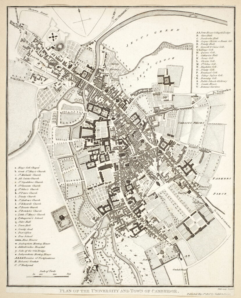
Image Information
Citation: Neele (engraver); Cadell & Davis (publisher; printed in Lyson’s Magna Britannia (vol. II)). Map of Cambridge. Plan of University & Town. 1808. Printed map, 23 x 18.5 cm. Archives of the Cambridge Antiquarian Society, University of Cambridge, Cambridge.Permissions: Public Domain.
Credit:
Associated timeline dates:
Tagged: Shepherd